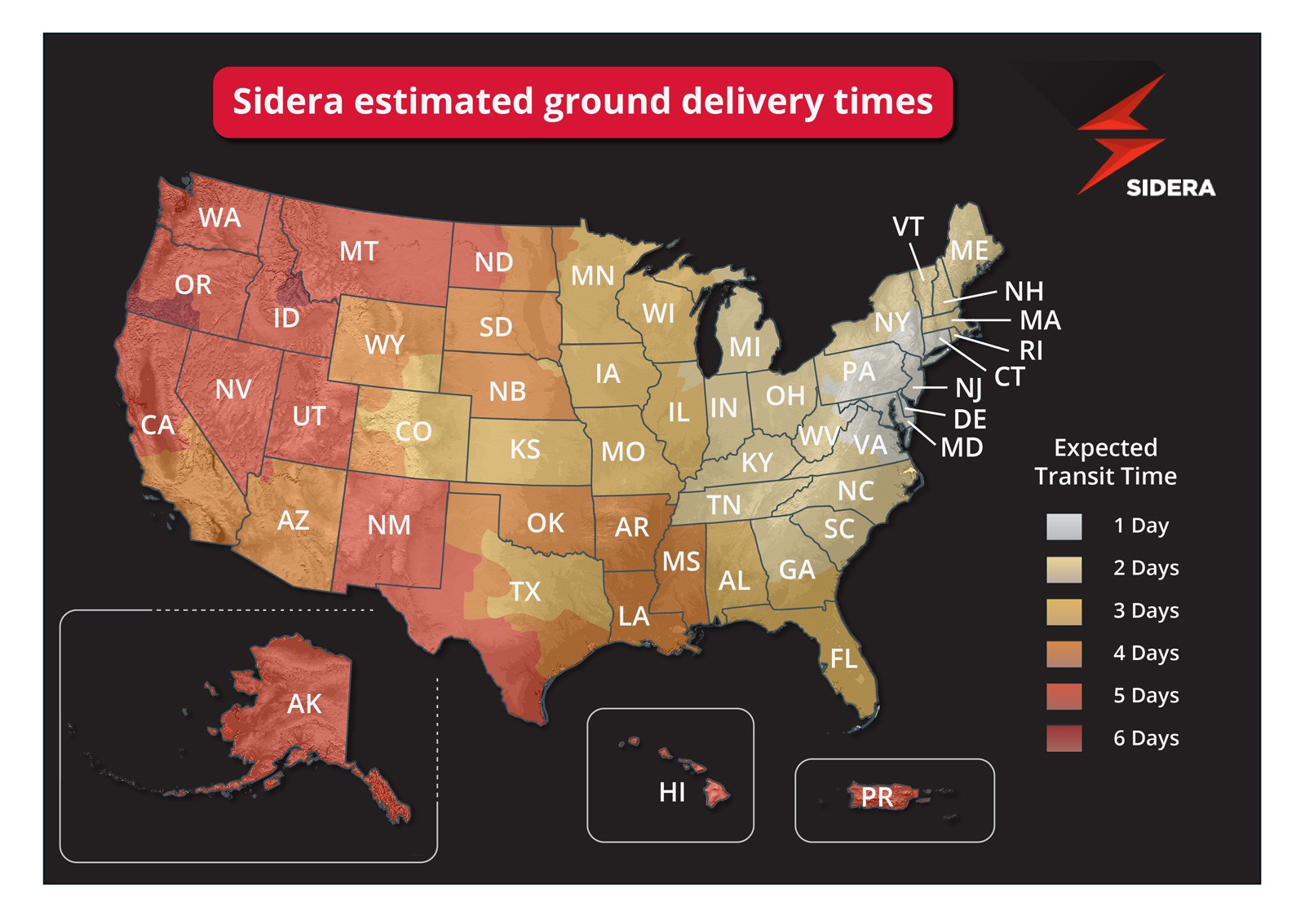
The client was very specific about not ending up with a standard flat UPS delivery map. I opted for adding in ground elevation data from ArcGIS to help add graphical interest as well as useful geographical information.