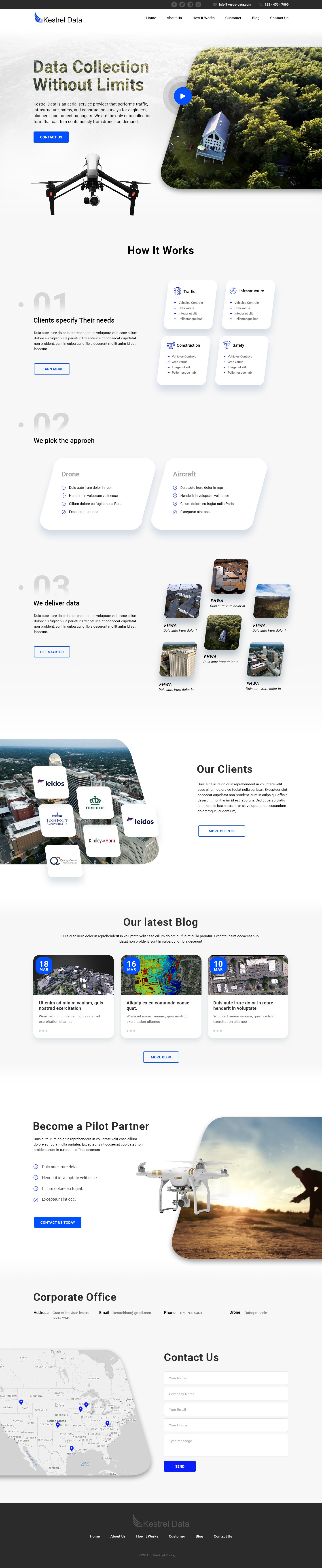
Aerial Data Collection Service Needs Everything, Starting with Website

8
Created on 99designs by Vista
Kestrel Data is an aerial imaging service provider that performs traffic, infrastructure and construction surveys for engineers, planners and project managers. Our principal means of data collection is with drones but for larger scale projects we use fixed wing aircraft. Our primary clients are private engineering firms and public agencies, including state DOTs and FHWA. While I said "construction" as industry, it's more professional services in the engineering industry.